Map projections and coordinate systems > Supported map projections
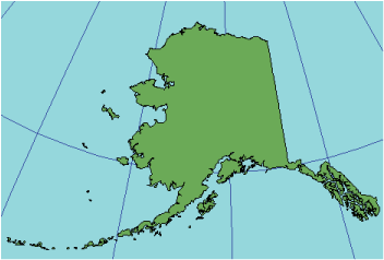
Alaska Grid |
|
|
Release 9.2
Last modified August 3, 2007 |


Print all topics in : "Supported map projections" |
Description
This projection was developed to provide a conformal map of Alaska with less scale distortion than other conformal projections. A set of mathematical formulas defines a conformal transformation between two surfaces (Snyder, 1993).
Projection method
Modified planar. This is a sixth-order equation modification of an oblique Stereographic conformal projection on the Clarke 1866 spheroid. The origin is at 64° N, 152° W.
Point of tangency
Conceptual point of tangency at 64° N, 152° W.
Linear graticules
None
Properties
Shape
Perfectly conformal.
Area
Varies approximately 1.2 percent over Alaska.
Direction
Local angles are correct everywhere.
Distance
The minimum scale factor is 0.997 at approximately 62°30' N, 156° W. Scale increases outward from this point. Most of Alaska and the Aleutian Islands, excluding the panhandle, are bounded by a line of true scale. The scale factor ranges from 0.997 to 1.003 for Alaska, which is one-fourth the range for a corresponding conic projection (Snyder, 1987).
Limitations
Distortion becomes severe away from Alaska.
Uses and applications
Conformal mapping of Alaska as a complete state on the Clarke 1866 spheroid or NAD27. This projection is not optimized for use with other datums and spheroids.
Parameters
Projection-specific parameters are set by the software.