Map projections and coordinate systems > Supported map projections
Bonne |
|
|
Release 9.2
Last modified August 3, 2007 |


Print all topics in : "Supported map projections" |
Description
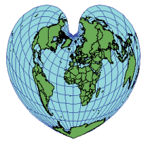
This equal-area projection has true scale along the central meridian and all parallels. Equatorial aspect is a Sinusoidal. Polar aspect is a Werner.
Projection method
Pseudo conic. Parallels of latitude are equally spaced concentric circular arcs, marked true to scale for meridians.
Point of tangency
A single standard parallel with no distortion.
Linear graticules
The central meridian.
Properties
Shape
No distortion along the central meridian and standard parallel; error increases away from these lines.
Area
Equal area.
Direction
Locally true along central meridian and standard parallel.
Distance
Scale is true along the central meridian and each parallel.
Limitations
Usually limited to maps of continents or smaller regions. Distortion pattern makes other equal-area projections preferable.
Uses and applications
Used during the 19th and early 20th centuries for atlas maps of Asia, Australia, Europe, and North America. Replaced with the Lambert Azimuthal Equal Area projection for continental mapping by Rand McNally & Co. and Hammond, Inc.
Large-scale topographic mapping of France and Ireland, along with Morocco and some other Mediterranean countries (Snyder, 1993).
Learn more about the Lambert Azimuthal Equal Area projection
Parameters
Desktop
- False Easting
- False Northing
- Central Meridian
- Standard Parallel 1
Workstation
- Longitude of projection center
- Latitude of projection center
- False Easting (meters)
- False Northing (meters)