Show Navigation
|
Hide Navigation
You are here:
Map projections and coordinate systems > Supported map projections
Map projections and coordinate systems > Supported map projections
Cube |
|
|
Release 9.2
Last modified August 3, 2007 |


Print all topics in : "Supported map projections" |
Related Topics
Description
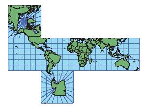
A faceted projection that is used for ArcGlobe.
Projection method
The world is projected onto a six-sided figure with square sides.
Linear graticules
The meridians and parallels are straight lines.
Properties
Shape
Shapes are not maintained.
Area
Areas are not maintained.
Direction
Between +45° and -45° latitude, north, south, east, and west directions are accurate, but general directions are not. On the polar facets, directions are true from the center.
Distance
Between +45° and -45° latitude, scale is correct.
Limitations
Not recommended for general mapping.
Uses and applications
Used for ArcGlobe. Suitable for educational uses.