Map projections and coordinate systems > Supported map projections
Polyconic |
|
|
Release 9.2
Last modified August 3, 2007 |


Print all topics in : "Supported map projections" |
Description
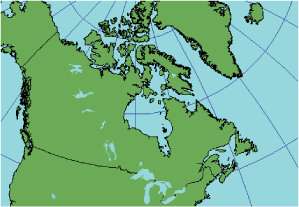
The name of this projection translates into "many cones". This refers to the projection methodology. This affects the shape of the meridians. Unlike other conic projections, the meridians are curved rather than linear.
Projection method
More complex than the regular conic projections, but still a simple construction. This projection is created by lining up an infinite number of cones along the central meridian. This projection yields parallels that are not concentric. Each line of latitude represents the base of its tangential cone.
Lines of contact
Many lines; all parallels of latitude in the projection.
Linear graticules
Central meridian of the projection and the equator.
Properties
Shape
No local shape distortion along the central meridian. Distortion increases with distance from the central meridian; thus, east–west distortion is greater than north–south distortion.
Area
Distortion in area increases with distance from the central meridian.
Direction
Local angles are accurate along the central meridian; otherwise, they are distorted.
Distance
The scale along each parallel and along the central meridian of the projection is accurate. Distortion increases along the meridians as the distance from the central meridian increases.
Limitations
Distortion is minimized on large-scale maps, such as topographic quadrangles, where meridians and parallels can be drawn in practice as straight-line segments. Producing a map library with this kind of map sheet is not advisable because errors accumulate and become visible when joining sheets in multiple directions.
Uses and applications
Used for 71/2 and 15 minute topographic USGS quad sheets, from 1886 until approximately 1957.
Some new quad sheets after this date have been falsely documented as Polyconic. The present projection for east–west State Plane Coordinate System zones is Lambert Conformal Conic and Transverse Mercator for north–south state zones.
Learn more about the State Plane Coordinate System
Learn more about the Lambert Conformal Conic projection
Learn more about the Transverse Mercator projection
Parameters
Desktop
- False Easting
- False Northing
- Central Meridian
- Latitude of origin
Workstation
- Longitude of Central Meridian
- Latitude of projection's origin
- False Easting (meters)
- False Northing (meters)