Map projections and coordinate systems > Supported map projections
Universal Polar Stereographic |
|
|
Release 9.2
Last modified August 3, 2007 |


Print all topics in : "Supported map projections" |
Description
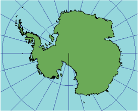
Universal polar stereographic (UPS) maps areas north of 84° N and south of 80° S that aren't included in the UTM coordinate system. The projection is equivalent to the polar aspect of the stereographic projection of the spheroid with specific parameters. The central point is either the North Pole or the South Pole.
Learn more about the Polar Stereographic projection
Projection method
Approximately (for the spheroid) planar perspective projection, where one pole is viewed from the other pole. Lines of latitude are concentric circles. The distance between circles increases away from the central pole. The origin at the intersection of meridians is assigned a false easting and false northing of 2,000,000 meters.
Lines of contact
The latitude of true scale, 81°06'52.3" N or S, corresponds to a scale factor of 0.994 at the pole.
Linear graticules
All meridians.
Properties
Shape
Conformal. Accurate representation of local shape.
Area
The farther from the pole, the greater the area scale.
Direction
True direction from the pole. Local angles are correct everywhere.
Distance
In general, the scale increases with distance from the pole. Latitude 81°06'52.3" N or S has true scale. The scale closer to the pole is reduced.
Limitations
The UPS is normally limited to 84° N in the north polar aspect and 80° S in the south polar aspect.
Uses and applications
Conformal mapping of polar regions.
Used for mapping polar regions of the UTM coordinate system.
Parameters
Workstation
- Pole < NORTHPOLE | SOUTHPOLE >