Geocoding and address management
What is a geometric network? |
|
|
Release 9.3
Last modified July 14, 2009 |


Print all topics in : "Geocoding and address management" |
NOTE: Although geometric networks can be created and edited in ArcInfo and ArcEditor, they are read-only in ArcView.
Geometric networks offer a way to model common networks and infrastructures found in the real world. Water distribution, electrical lines, gas pipelines, telephone services, and water flow in a stream are all examples of resource flows that can be modeled and analyzed using a geometric network.
A geometric network is a set of connected edges and junctions along with connectivity rules that are used to represent and model the behavior of a common network infrastructure in the real world. Geodatabase feature classes are used as the data sources to define the geometric network. You define the roles that various features will play in the geometric network and rules for how resources flow through the geometric network.
In the following graphic, a geometric network models the flow of water through water mains and water services, which are connected by water junction fittings:

A geometric network is built within a feature dataset in the geodatabase. The feature classes in the feature dataset are used as the data sources for network junctions and edges. The network connectivity is based on the geometric coincidence of the feature classes used as data sources.
Geometric networks comprise two main elements: edges and junctions.
Edges—An edge is a feature that has a length through which some commodity flows. Edges are created from line feature classes in a feature dataset and correspond to edge elements in a logical network.
Examples of edges: Water mains, electrical transmission lines, gas pipelines, and telephone lines.
Junctions—A junction is a feature that allows two or more edges to connect and facilitates the transfer of flow between edges. Junctions are created from point feature classes in a feature dataset and correspond to junction elements in the logical network.
Examples of junctions: Fuses, switches, service taps, and valves.
Edges and junctions in a network are topologically connected to each other—edges must connect to other edges at junctions; the flow from edges in the network is transferred to other edges through junctions.
There are two types of edges in a geometric network:
-
Simple Edges—Simple edges are always connected to two junctions, one at each end.
An example of a simple edge would be a water lateral in a water network. The water lateral connects at one end to a junction along the main distribution line and, at the other end, to a service point junction (such as a tap or pump). -
Complex Edges—Complex edges are always connected to at least two junctions at their endpoints but can be connected to additional junctions along their length.
An example of a complex edge would be a water main in a water network. The main water distribution line is a single complex edge with multiple lateral lines connected to junctions along its length. The water main is not split at the junction where each lateral connects to the main.
Simple edges have no mid-span connectivity. If a new junction is snapped mid-span on a simple edge, thereby establishing connectivity, then that simple edge is physically split into two features.
A simple edge corresponds to a single edge element in the logical network.
Complex edges have mid-span connectivity. If a new junction is snapped mid-span on a complex edge, that complex edge remains a single feature. Snapping the junction does cause the complex edge to be split logically—for example, if it corresponded to one edge element in the logical network before the junction was connected, it now corresponds to two edge elements.
Complex edges correspond to one or more edge elements in the logical network.
There are two types of junctions in a geometric network:
-
User-defined junctions—Junctions that are created based on a user's source data (point feature classes) when the geometric network is first established. Junctions correspond to a single junction element in the logical network.
-
Orphan junctions—When the first edge feature class is added to the geometric network, a simple junction feature class is created, called the orphan junction feature class. The name of the orphan junction feature class corresponds to the name of the geometric network appended with _Junctions. For example, a geometric network named Electric_Net would have a corresponding orphan junction feature class named Electric_Net_Junctions. The orphan junction feature class is used by the geometric network to maintain network integrity.
During the creation of the geometric network, an orphan junction is inserted at the endpoint of any edge at which a geometrically coincident junction does not already exist in your source data. Orphan junction features can be removed from the geometric network by subsuming them with other junction features. To subsume an orphan junction is to incorporate it into the network by deleting it and replacing it with a user-defined junction while still maintaining network connectivity.
Learn more about junction subsumption.
The orphan junction feature class is deleted when its geometric network is deleted. For this reason, the schema of the orphan junction feature class should not be modified.
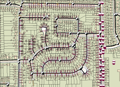
The image below shows an example of a network as it would appear in ArcMap.
The logical network
When a geometric network is created, ArcGIS also creates a corresponding logical network, which is used to represent and model connectivity relationships between features. The logical network is the connectivity graph used for tracing and flow calculations.
An edge or junction element in the geometric network corresponds to one or more edges or junctions in the logical network. All connectivity between edges and junctions is maintained in the logical network.
The logical network is managed as a collection of tables that are created and maintained by ArcGIS. These tables record how the features involved in a geometric network are connected to one another. The logical network allows ArcGIS to quickly discover and model the connectivity relationships between connected edges and junctions in a geometric network during editing and analysis. This allows for fast network tracing and facilitates the generation of on-the-fly connectivity while editing.
When edges and junctions are edited or updated in the geometric network, the corresponding logical network is automatically updated and maintained as well.
The following graphic shows how a water main, represented by a single complex edge in the geometric network, comprises multiple elements in the logical network. The water main's corresponding tables in the logical network are created and maintained by ArcGIS. When edits are made to the water main in the geometric network, ArcGIS automatically updates the corresponding elements in the logical network, and connectivity between features in the geometric network is maintained.

Sources and sinks
Networks are often used to model real-world systems where the direction of movement through the network is well-defined. For example, the flow of electricity in an electrical network is from the power generation station to the customers. In a water network, the flow direction may not be as well-defined as in an electric network, but the flow of water may be from a pump station to a customer or from customers to a treatment plant.
Flow direction in a network is calculated from a set of sources and sinks. In the above examples, electricity and water flow are driven by sources and sinks. Flow is away from sources, such as the power generation station or a pump station, and toward sinks, such as a water treatment plant (in the case of a wastewater network).
Junctions in geometric networks can act as sources or sinks. When you create a new junction feature class in a network, you can specify whether the features stored in it can represent sources, sinks, or neither in the network. If you specify that these features can be sources or sinks, a field called AncillaryRole is added to the feature class to record if the feature is a source, sink, or neither a source nor a sink. When you calculate the flow direction for a geometric network in ArcMap, the flow direction will be calculated based on the sources and sinks in the network.
For example, you may have a tank in your water network that is down for maintenance, so its role in the network will be changed (temporarily) from source to none. The flow for the network is recalculated by the system, and any traces on the network will be affected by the change in flow direction caused by the state of the tank.
Learn more about network tracing.
Network weights
A network can have a set of weights associated with it. A weight can be used to represent the cost of traversing an element in the logical network. For example, in a water network, a certain amount of pressure is lost when traveling the length of a transmission main due to surface friction within the pipe.
Network weights apply to all elements in the network. Weight values for each network element are derived from attributes on the corresponding feature. In the transmission main example above, the weight value is derived from the length attribute of the feature.
A network can have any number of weights associated with it. Each feature class in the network may have some, all, or none of these weights associated with its attributes. The weight for each feature is determined by an attribute for that feature. A network weight can be associated with only one attribute in a feature class. The weight can also be associated with multiple feature classes. For example, a weight called Diameter can be associated with the attribute Diameter in the water main feature class and as well as with the attribute Pipe_dia in the water lateral feature class.
A network weight value of zero is reserved and is assigned to all orphan junctions. Also, if a weight is not associated with any attributes of a feature class, then the weight values for all network elements corresponding to that feature class will be zero.
Enabled and disabled features
Any edge or junction in a geometric network may be enabled or disabled in the logical network. A feature that is disabled in the logical network acts as a barrier. When the network is traced, the trace will stop at any barriers it encounters in the network including disabled network features.
The enabled or disabled state of a network feature is a property maintained by an attribute field called Enabled. It can have one of two values: true or false. When building a geometric network from simple feature classes, this field is automatically added to the input feature classes. When you use ArcCatalog to create a network feature class, Enabled is a required field for the feature class.
When adding new features to a network, they are enabled by default.
Values stored in the network weight, ancillary role, and enabled fields are the user's view of the state of the feature in the logical network. When analysis—such as tracing and flow direction calculation—is performed against a network feature, the value of these fields within the feature is not directly referenced to determine the enabled, ancillary role state of the feature or its weight. Instead, these states of the feature are stored in the logical network, which is queried during these operations. This is done for performance reasons.
When you edit a network feature and change the value of the enabled, ancillary role, or weight field, the state of the feature in the internal topology tables is modified to remain in sync with the field values of the feature.
Performance considerations
Geometric networks can be composed of a number of edge and junction feature classes. When editing geometric networks in ArcMap, connectivity relationships between features are maintained while editing on the fly. The benefit of this model is that there is no need to perform a postediting process to build connectivity. The cost of continually maintaining network connectivity imposes overhead on the time it takes to add or modify features in network feature classes.
Connectivity in a network feature class is based on geometric coincidence. If a junction is added along an edge, the edge and junction will become connected to one another. When a new feature is added to a network feature class, this geometric coincidence must be discovered. So each feature class in the network must be analyzed by performing a spatial query against it to determine if the new feature is coincident with network features. If coincidence is discovered, then network connectivity is established.
When discovering connectivity, a separate spatial query must be executed on the server for each feature class in the network. If you use the map cache while editing the network, these spatial queries do not need to go against the server and are much faster. You will not pay as much of a penalty in performance for having a large number of feature classes in your network if you use the map cache. Using the map cache when editing your network features will significantly improve performance when adding new features or connecting and moving existing features.
Learn how to edit geometric network features.
Learn more about working with the map cache.
Try to reduce the number of feature classes you have in your geometric network by lumping feature classes together using subtypes. If your feature classes carry different attributes, you can use relationships to manage subtype-specific attributes in different tables in the database, or you can keep all the attributes in the same table using nulls for those that don't apply to a particular subtype.