 Feedback
 E-mail this topic
 Print this topic
| Add GPS Data Files |
Feedback
E-mail this topic
Print this topic
|
You can add data captured with a GPS device by converting the data to a file in GPS Exchange Format. Numerous third-party and GPS manufacturer utilities exist to perform this conversion.
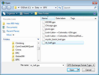
Once you've selected the file to display you'll see the Add GPS Data File dialog which will let you specifiy which data type(s) to add:
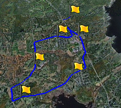
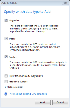 | Waypoints These are points that the GPS user recorded manually, often specifying a name, to mark addant locations on the map. |
| Tracks These are points the GPS device recorded automatically at a periodic interval. Tracks are rendered as linear features. | |
| Routes These are points the GPS device used to navigate to a specified location. Routes are rendered as linear features. |
Clicking add adds the data types you've selected to the map
You can change the symbols assigned to the various data types you've chosen to display by right-clicking a waypoint, track, or route in the Contents window and in the context menu that appears, choose Properties. In the dialog presented, choose Symbol.
See a table of which GPS icons map to which ArcExplorer symbols.