Subscribe to GeoRSS feeds FeedbackFeedback E-mail this topicE-mail this topic Print this topicPrint this topic
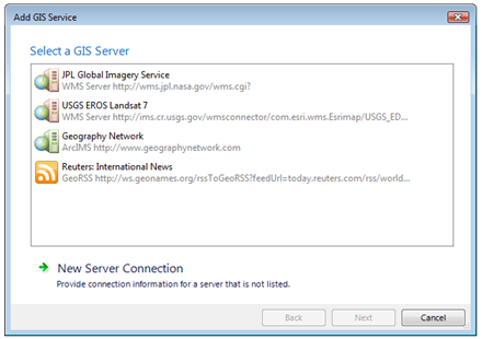
Many sources of changing information use RSS as a means of syndicating their content and making it available to subscribers in what is known as a 'feed'. In the same way that news aggregators or other RSS-aware applications can keep up with and check a feed for changes and react to the changes in an appropriate way, you can use ArcGIS Explorer to subscribe to a service that provides content that is geographically tagged with encodings in one of the supported GeoRSS formats. 
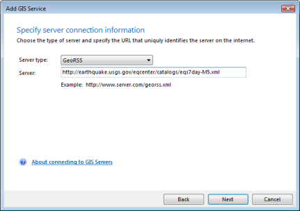
At present ArcGIS Explorer supports geometries from the following feed types and in the following formats:
  1. GeoRSS supported feed types
    • RSS 2.0
    • Atom 1.0

  2. GeoRSS supported formats
    • W3C Geo
    • GeoRSS-Simple
    • GML
To connect to a GeoRSS service
  1. On the Home tab, in the Map group, click Add Content and select GIS Services...
  2. If you've not established a connection to the GIS Server that provides the GeoRSS feed, click New Server Connection. If you've already established a connection, double-click its name.

  3. Choose GeoRSS as the Server type.
  4. Specify the URL of the Server.

  5. Click Next.
  6. Specify the frequency with which you want to check for information from the feed.

  7. Click Finish.
  8. A layer, representing the GeoRSS service appears in the Contents window. You can change the symbols of the layer in the Symbols group on the Appearance tab. In addition, Explorer stores the connection information to the server that provides the GeoRSS feed; the next time you want to add a feed to a map, it will be available to you.
Learn more about refreshing GeoRSS information