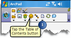
Displaying a layers symbology


Displaying a layers symbology |
|
| Release 8 |


|


ArcPad displays the layer’s symbology.

When checked, the symbol shown will be used to display features with the corresponding attribute values. When unchecked, no symbol will be displayed for features with the corresponding attribute value.
The Symbol Properties dialog box opens and enables you to define your simple and complex symbology.
 button. You can then specify the symbol, field
value and label for the new category.
 Tap the  button to save the
changes to the legend to the ArcPad Layer file (.apl).
 will appear when a
legend category has been selected. Tap the delete button to delete the
selected legend category.
 Tap the button  to save the changes to
the legend to the ArcPad Layer file (.apl).