Map projections and coordinate systems > Supported map projections
Lambert Azimuthal Equal Area |
|
|
Release 9.3
Last modified October 21, 2008 |


Print all topics in : "Supported map projections" |
Description
This projection preserves the area of individual polygons while simultaneously maintaining a true sense of direction from the center. The general pattern of distortion is radial. It is best suited for individual land masses that are symmetrically proportioned, either round or square.
Projection method
Planar, projected from any point on the globe. This projection can accommodate all aspects: equatorial, polar, and oblique.
Point of tangency
A single point, located anywhere, specified by longitude and latitude.
Linear graticules
- All aspects—the central meridian defining the point of tangency.
- Equatorial aspect—the equator.
- Polar aspect—all meridians.
Properties
Shape
Shape is minimally distorted, less than 2 percent, within 15° from the focal point. Beyond that, angular distortion is more significant; small shapes are compressed radially from the center and elongated perpendicularly.
Area
Equal area.
Direction
True direction radiating from the central point.
Distance
True at center. Scale decreases with distance from the center along the radii and increases from the center perpendicularly to the radii.
Limitations
The data must be less than a hemisphere in extent. The software cannot process any area more than 90° from the central point.
Uses and applications
- Population density (area).
- Political boundaries (area).
- Oceanic mapping for energy, minerals, geology, and tectonics (direction).
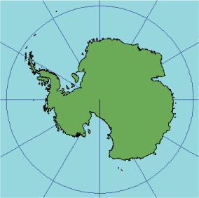
- This projection can handle large areas; thus, it is used for displaying entire continents and polar regions.
- Equatorial aspect: Africa, Southeast Asia, Australia, the Caribbean, and Central America.
- Oblique aspect: North America, Europe, and Asia.
Parameters
Desktop
- False Easting
- False Northing
- Central Meridian
- Latitude of Origin
Lambert Azimuthal Auxiliary Sphere (Desktop version 9.3 and later)
- False Easting
- False Northing
- Central Meridian
- Latitude of Origin
- Auxiliary Sphere Type
NOTE: The Auxiliary Sphere Type parameter accepts 0 (use semimajor axis or radius of the geographic coordinate system), 1 (use semiminor axis or radius), 2 (calculate and use authalic radius), or 3 (use authalic radius and convert geodetic latitudes to authalic latitudes).
Workstation
- Radius of sphere of reference
- Longitude of center of projection
- Latitude of center of projection
- False Easting
- False Northing
NOTE: Supported on spheres only.