Extensions > Network Analyst > Performing network analysis
Network analysis work flow |
|
|
Release 9.3
Last modified March 2, 2010 |


Print all topics in : "Performing network analysis" |
All network analyses in ArcGIS Network Analyst follow a similar workflow.
The basic steps to perform any type of network analysis in ArcGIS are:
-
Creating the analysis layer
-
Adding network locations
-
Setting analysis properties
-
Performing the analysis and displaying the results
Creating the analysis layer
What are network analysis layers?
Network analysis layers are composite layers in ArcMap used to store inputs, properties, and results of network analyses.
A network analysis layer acts as an in-memory workspace for each type of input as well as the result, all of which are stored as in-memory feature classes. The analysis properties are stored as properties of the analysis layer.
There are five kinds of network analysis layers:
-
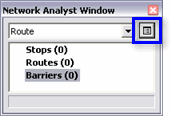
Route analysis layer—This layer contains the input network locations (stops and barriers), properties, and the resultant route or routes of a route analysis.
Learn more about the route analysis layer. -
Closest facility analysis layer—This layer contains the input network locations (facilities, incidents, and barriers), properties, and the resultant route or routes of a closest facility analysis.
Learn more about the closest facility layer. -
Service area analysis layer—This layer contains the input facilities and barriers, properties, and the resultant service area polygons and service area lines.
Learn more about the service area analysis layer. -
OD cost matrix analysis layer—This layer contains the input origins and destinations, properties, and results of an OD cost matrix analysis.
Learn more about the OD cost matrix analysis layer. -
Vehicle routing problem analysis layer—This layer contains the input network analysis objects (orders, depots, routes, depot visits, breaks, route zones, route seed points, route renewals, specialties, order pairs, and barriers), properties, and the results of a vehicle routing problem analysis.
Learn more about the vehicle routing problem analysis layer.
How are network analysis layers created?
A network analysis layer is created when you choose a new type of analysis from the ArcGIS Network Analyst menu on the Network Analyst toolbar. The kind of network analysis layer created is based on the type of new network analysis you choose.
Network analysis layers can also be created using geoprocessing tools, such as Make Route Layer, in the Analysis toolset in the Network Analyst toolbox.
Each layer represents the various inputs and results that are part of the network analysis layer, and behaves as other feature layers in ArcMap. The layers support labels, joins and relates, symbology, and all other layer properties that are common to feature layers. You can also export these in-memory feature classes to feature classes on disk. Alternatively, the entire network analysis layer can be saved to a .lyr file, which would contain the serialized in-memory feature classes referenced by the network analysis sublayers. The .lyr file can be added to other map documents. Although saving individual network analysis sublayers to .lyr files is possible, these .lyr files don't save the underlying in-memory feature class within the layer file.
Removing network analysis layers
You can remove any analysis layer by right-clicking it in the table of contents and clicking Remove on the context menu. This removes the analysis layer from the table of contents, the Network Analyst window, and the map. In addition, all network locations associated with the analysis, along with all the results that were generated, are also removed.
NOTE: If you have inputs or results in your network analysis layer that you want to retain for future use, you must export each of those to a feature class, shapefile, or table. Once the network analysis layer is removed, you cannot recover the inputs or results stored in the layer.
Adding network locations
Adding network analysis objects
Network analysis objects are features or records used as input and output during network analysis such as stops, barriers, routes, and route zones.
Learn more about network analysis objects.
Setting analysis properties
Properties used for network analysis include the impedance to be used, the restrictions to be obeyed, the U-turn policy, output shape type, accumulation attributes, and properties for finding network locations. Additionally, each kind of analysis has specific properties of its own.
Learn more about properties for route analysis.
Learn more about properties for closest facility analysis.
Learn more about properties for service area analysis.
Learn more about properties for OD cost matrix analysis.
Learn more about properties for vehicle routing problem analysis.
The properties for performing an analysis are set on the analysis layer's dialog box, which can be accessed by any of the following methods:
- In the Network Analyst window, click the Network Analysis Layer Properties button next to the analysis layer.
- When the Create Network Location tool
 or the Select/Move Network Locations tool
  is active, right-click on the map and click Properties.
- In the table of contents, right-click the analysis layer and click Properties to open the Analysis Layer Properties dialog box.
- In the table of contents, double-click the analysis layer to open the Analysis Layer Properties dialog box.


You can also change some of the default behavior of Network Analyst from the options menu.
Learn more about changing the default options of Network Analyst.
Performing the analysis and displaying the results
Once you have created your analysis layer, added input network locations, and set the parameters for analysis on the Network Analyst toolbar, click the Solve Analysis button ![]() to generate the results. These results are part of the network analysis layer.
to generate the results. These results are part of the network analysis layer.
Since the output is a feature layer, it can be symbolized in the same manner as any other feature layer in ArcMap.
Learn more about symbolizing your data.
The results vary by the type of analysis performed.
Learn more about finding the best route.
Learn more about finding the closest facility.
Learn more about finding a service area.
Learn more about creating an OD cost matrix.
Learn more about servicing a set of orders using a fleet of vehicles.
If you see unexpected results, see Troubleshooting network analyses.