Extensions > Spatial Analyst > Analysis concepts > Surface analysis
Producing a hillshade |
|
|
Release 9.3
Last modified January 13, 2012 |


Print all topics in : "Surface analysis" |
Note:
This topic was updated for 9.3.1.
The Hillshade tool obtains the hypothetical illumination of a surface by determining illumination values for each cell in a raster. It does this by setting a position for a hypothetical light source and calculating the illumination values of each cell in relation to neighboring cells. It can greatly enhance the visualization of a surface for analysis or graphical display, especially when using transparency.
Learn how to calculate hillshade using the Spatial Analyst toolbar
Learn how to calculate hillshade using the Hillshade tool
By default, shadow and light are shades of gray associated with integers from 0 to 255 (increasing from black to white).
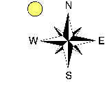
The azimuth is the angular direction of the sun, measured from north in clockwise degrees from 0 to 360. An azimuth of 90 is east. The default is 315 (NW).
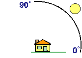
The altitude is the slope or angle of the illumination source above the horizon. The units are in degrees, from 0 (on the horizon) to 90 (overhead). The default is 45 degrees.
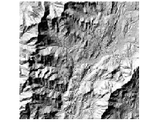
The hillshade below has an azimuth of 315 and an altitude of 45 degrees.
Using hillshade for display
By placing an elevation raster on top of a hillshade raster and adjusting the transparency of the elevation raster, you can easily create a visually appealing relief map of a landscape.
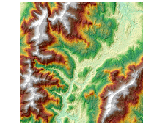
Add other layers, such as land use types, vegetation, roads, or streams to further increase the informational content in the display.
Using hillshade in analysis
By modeling shade (the default option), you can calculate the local illumination and whether the cell falls in a shadow or not.
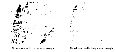
By modeling shadow, you can identify each cell that will be in the shadow of another cell at a particular time of day. Cells that are in the shadow of another cell are coded 0; all other cells are coded with integers from 1 to 255. You can reclassify all values greater than 1 to 1, producing a binary output raster. In the example below, the black areas are in shadow. The azimuth is the same in each image, but the sun angle (altitude) has been modified.
