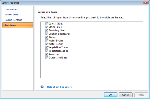
Some GIS Services are structured hierarchically to better organize their content. For example, a WMS service layer is made up of three entries that are arranged hierarchically. At the top is the name of WMS service , which holds all the WMS map layers. The next level is WMS group layers, whose only function is to organize WMS sublayers into related groups. There is at least one WMS group layer, but there can be can be any number of WMS group layers (and even nested groups within groups). WMS group layers do not hold any map layers; it is the third group, WMS sublayers, that actually contains the map layers. ArcIMS services as well as ArcGIS Server services may have sublayers as well. When you add a GIS service you can control which sublayers to display by right-clicking the layer in the Contents window and then, in the context menu, selecting Properties. In the Layer Properties dialog that appears, choose Sub-layers. If the Service contains sublayers, you'll see them listed:

If you uncheck a sublayer it won't draw on the map, nor will it be listed in the Legend window.
If the Service doesn't contain any sublayers, the property page will reflect this:

 Feedback
 E-mail this topic
 Print this topic
 Feedback
 E-mail this topic
 Print this topic

