Steps
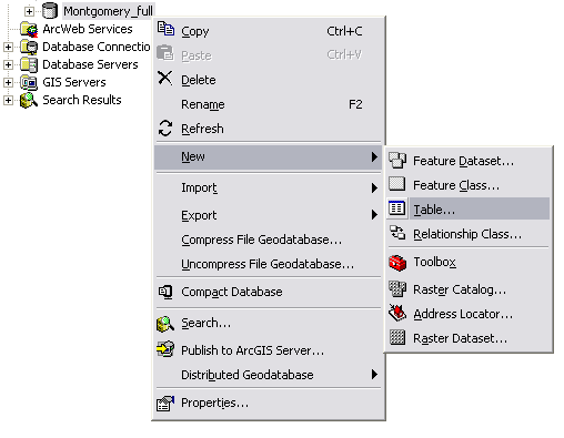
- In the ArcCatalog tree, right-click the database in which you want to create a new table, point to New, and Click Table. A wizard for defining a new table will appear.

- Type a name for the table. To create an alias for this table, type the alias. Click Next.
-
NOTE: If your geodatabase is not a file or ArcSDE geodatabase, skip this step.
If you are creating a new table within a file geodatabase, you can choose an optional configuration keyword for setting up your table to manage text fields in various languages. Using the DEFAULTS keyword, in most cases, is a reasonable and intelligent choice.
NOTE: If you want to store Asian characters such as Japanese or Chinese in text fields within your table in a file geodatabase, you may want to choose the TEXT_UTF16 keyword choice for file geodatabases.
For more information, refer to Configuration keywords for file geodatabases and Configuration keywords for ArcSDE geodatabases.
- To add a field to the table, click the next blank row in the Field Name column and type a name.
- Click in the Data Type column next to the new field's name, then click its data type.
- To create an alias for this field, click the field next to Alias and type the alias for this field.
- To prevent nulls from being stored in this field, click the field next to Allow nulls, click the drop-down arrow, then click No.
- To associate a default value with this field, click the field next to Default value and type the value.
- To associate a domain with this field, click the field next to Domain, click the drop-down arrow to see a list of the domains that apply to this field type, and click the domain.
- To set other properties specific to the type of field, either click the property in the drop-down list or type the property.
- Repeat steps 8 through 14 until all the table's fields have been defined.
- Click Finish.
NOTE:
- All simple tables in the geodatabase require an ObjectID type field. The ObjectID field uniquely identifies each object stored in the table in the database.
- When creating a new table, you can use another table as a template. Click Import, navigate to the table that contains the field definitions you want to copy, then click OK. Now you can edit the field names and their data types.
- If you have entered a field that you don't want included in the new table, select it by clicking its tab in the grid, then press the Delete key.
Steps
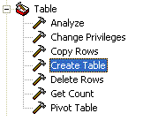
- In ArcToolbox, you can find the Create Table tool in the toolbox named Data Management Tools. It is contained in the Tables toolset.

- Specify the name of the geodatabase in which the new table is to be created or specify the name of the output workspace (file folder) in which a new dBASE table is to be created.
- Provide the new table name and an optional table whose fields can be used as a template for the fields in the new table.
- Set a configuration keyword if necessary for managing text fields in various languages. If you are creating a new table within a file geodatabase, you can choose an optional configuration keyword for setting up your table. Using "Defaults" in most cases is a reasonable and intelligent choice.
NOTE: If you want to store Asian characters such as Japanese or Chinese in text fields within your table in a file geodatabase, you may want to choose the TEXT_UTF16 keyword choice.
For more information, refer to Configuration keywords for file geodatabases.


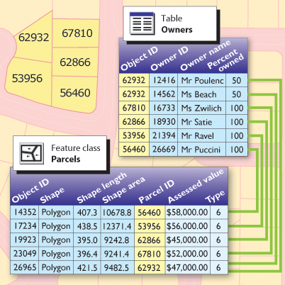
 ArcGIS users work with tables in many formats and sources including

