 |
Migrating to high precision |
|
| Release 9.3 |    |
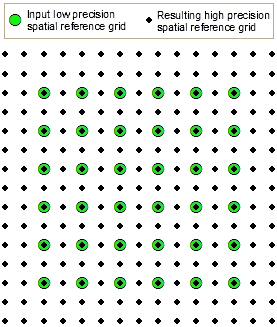
 Prior to ArcGIS 9.2, a feature class that included the entire earth could store features no closer than approximately 2 centimeters. Now you can store features as close as 10 nanometers, although it is not recommended you use such small values.
To take advantage of these benefits, converting data to high precision is recommended in most cases. If you have to deliver data to clients who have not upgraded or you are satisfied with your existing situation, you do not need to convert your data to high precision. The data will continue to work in ArcGIS as it always has.
Converting to high precision does not affect existing coordinate values. This means that you can safely convert any type of data, including topologies, geometric networks, and versioned data.
There are two general ways you can convert data to high precision:
NOTE: You do not have to compress versioned data before starting the upgrade process. Neither upgrading the geodatabase nor upgrading the spatial reference will affect the coordinate values of your data. If you copy and paste versioned data to upgrade the spatial reference, only the currently connected version is copied. The output data will not be versioned.
NOTE: Specifying a resolution that is larger than the current resolution can generalize your data. Only specify a larger resolution when you're sure it is not going to adversely affect your application.
The Import/Export geoprocessing tools do not support migrating attribute domains, relationship classes, topologies, geometric networks, network datasets, and terrains. To migrate these to a default resolution that will be chosen for you, copy and paste the data. To choose your own resolution, use the Upgrade Spatial Reference tool before you copy and paste.NOTE: You can determine the precision of a stand-alone feature class or feature dataset in ArcCatalog by right-clicking the feature class or dataset and clicking Properties. The Data Storage is shown on the General tab of the Properties dialog box.