Displaying schematic diagrams


Displaying schematic diagrams |
|
| Release 9.3 |


|
Schematics diagram resources can not be directly published and displayed within ArcGIS Server. The following paragraphs explain the way of working to display schematic diagrams within ArcGIS Server.
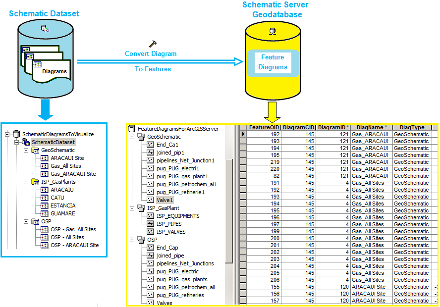
Schematics 9.3 provides a specific geoprocessing tool that allows schematic diagrams to be converted into Feature Diagrams to be consumed by ArcGIS Server. A Feature Diagram is a collection of features converted from the schematic elements contained in a given schematic diagram using the Convert Diagram To Features geoprocessing tool. Feature diagrams are stored in a Schematics Server Geodatabase. The Schematics Server Geodatabase's structure is organized around several feature datasets; each of them containing schematic features related to different diagrams implemented by a same diagram type (see Figure 1).
Learn more about the Convert Diagram To Features GP tool.

Figure 1: Converting schematic diagrams to feature diagrams
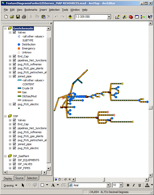
Due to this Schematics Server Geodatabase structure, it is then possible to build a map document organized around several data frames, one per feature dataset dedicated to a given diagram type (see Figure 2).

Figure 2: Authoring the map resource that will serve the feature diagrams
Once you have authored such a map document, you're ready to publish it as service. After publishing, all the converted schematic diagrams are available through the map service.
Then, a web application can be easily developed with a map resource manager associated with each feature dataset (that is, each type of diagram) served by the map service. This web application can also manage drop down boxes to filter out the feature diagram the client would like to display among all the feature diagrams displayed under a given feature dataset.
The following figure sums up the way of working to visualize schematic diagrams within ArcGIS Server that has just been detailled in the previous paragraphs.

Figure 3: Displaying schematic diagrams within ArcGIS Server