Layer definitions


Layer definitions |
|
| Release 8 |
|
Layer definitions provide a way of delivering customizations that are loaded with data. Typically, this would include data entry forms with associated scripts to handle data entry validation and other features offered on the forms. The layer definition file can also contain symbology created in ArcPad or exported from the ArcPad Data Manager for ArcGIS Desktop.
Layer definitions are stored in ArcPad AXF files or in a file associated with a shapefile. This file has the same filename as the shapefile, but has an .apl extension. The layer definition file lives and travels with the shapefile.
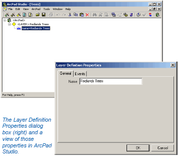
The forms and scripts portion of layer definitions are created in ArcPad Studio. The symbology portion is created in ArcPad, or ArcGIS Desktop using the ArcPad Data Manager. These two procedures can be done in either order. The layer definition file is stored in ArcPad XML format.
For shapefiles this layer defintion is stored in a file with the extension (.apl). For AXF's the layer definition is stored within the AXF itself.
Once the format of a layer definition has been defined in ArcPad Studio and/or using the ArcPad Data Manager for ArcGIS, it is possible to make changes or additions using ArcPad Studio. You can also use your favorite text or XML editor to make changes to a layer definition file associated with a shapefile.
Layer definitions are automatically loaded when the associated shapefile or ArcPad AXF file is added to ArcPad.
Data preparation for ArcPad, such as exporting a layer’s symbology, is performed in ArcGIS Desktop (ArcView, ArcEditor, or ArcInfo) using the ArcPad Data Manager. You can also set or change symbology directly in ArcPad. Symbology is stored in the layer definition file in ArcPad XML.