Starting the GPS Tracklog


Starting the GPS Tracklog |
|
| Release 8 |
|
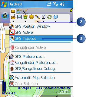
The GPS Tracklog layer display status is automatically changed to visible when the GPS Tracklog is started.
New GPS Tracklog positions are captured in the Tracklog shapefile and added to any previous points that may exist.
The tracklog positions are captured as a point shapefile; however, ArcPad displays the tracklog points as a red line