Selecting a layer for the Identify tool


Selecting a layer for the Identify tool |
|
| Release 8 |
|
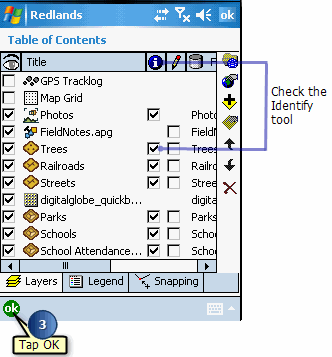
The Identify tool lets you view attribute information for a particular feature. Once a layer is selected for the Identify tool, make the Identify tool active, then tap the feature, and the Feature Properties dialog box appears. By default, the Feature Properties dialog box includes pages for Attributes, Picture, Symbology—if defined—and Geography. If a custom form exists for the feature, it will be displayed. You cannot edit your data using the Identify tool; you can only view it.
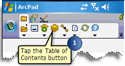
The Table of Contents opens on the Layers page and lists all of the layers in the current ArcPad map.