Activating the Map Grid layer


Activating the Map Grid layer |
|
| Release 8 |
|
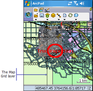
ArcPad allows you to include a Map Grid layer for your map. ArcPad displays the grid based on the current map projection. The size of each grid cell is automatically calculated by ArcPad, based on the current map scale. You can change the style of the lines and text using the Layer Properties dialog box for the Map Grid layer.
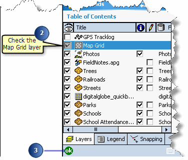
The Table of Contents opens on the Layers page.
The Map Grid layer is automatically generated for your ArcPad map.