Creating a new point feature using a 2 point offset


Creating a new point feature using a 2 point offset |
|
| Release 8 |
|
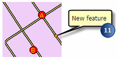
A 2 point offset enables you to create a point based on two reference points (A & B). The reference points can be set using a pen, GPS, or manually entered coordinates. There are two variations available in ArcPad for the 2 point offset: distance– distance and bearing–bearing.
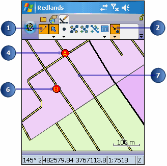
The Offset Point button is depressed on the Edit toolbar and a red box is placed around the Offset Point button in the drop-down list to indicate that it is active.
The Point/Vertex dialog box opens on the 2 Point Offset page.
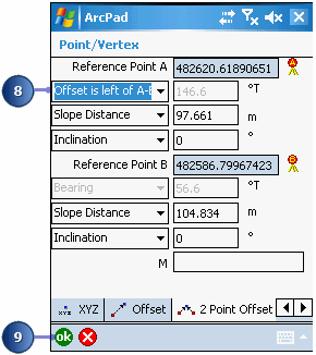
If you are using a rangefinder without a compass, you will need to specify whether the point you are capturing is to the left or to the right of an imaginary line between reference points A and B. You will also need to shoot a measurement twice, once for each distance from each reference point.
If you are only using a compass, you will be using two bearing measurements to calculate the offset.
The Feature Properties dialog box is displayed with an edit form, if it exists. Enter the information for the new feature.