What can you do with ArcPad


What can you do with ArcPad |
|
| Release 8 |


|
Using your existing data, ArcPad leverages existing mapping and GIS software systems and databases. ArcPad supports vector map and raster image display including numerous industry-standard formats. In addition, ArcPad supports most of the symbology used in ArcGIS Desktop, enabling you to display layers in your mobile GIS applications using the standards of your organization.


ArcPad provides a comprehensive set of tools users need for collecting and capturing data in the field including redlining using a graphics layer, and extensive support for capture devices such as GPS receivers, rangefinders, and cameras.

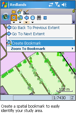
ArcPad has a number of map navigation tools, including variable zoom and pan, fixed zoom, zoom to a specified layer or spatial bookmark, and center on the current GPS position.

ArcPad enables you to identify features by tapping on them; display additional information about features through a hyperlink; navigate to a specific geographic coordinate; and locate a feature within the extent of your map, label it, and zoom to it.


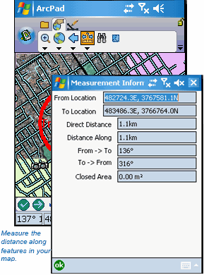
ArcPad lets you measure distance, area, and bearings on your map with three measuring tools: Measure, Freehand Measure, and Radial Measure.

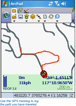
Connect a GPS to your mobile device and let ArcPad guide you. ArcPad provides navigational information from the current GPS position to the destination and a GPS tracklog that illustrates the path you have traveled.

In addition to displaying and querying spatial data, ArcPad allows you to create and edit spatial data using input from either the mouse pointer, pen, GPS, or rangefinder. ArcPad also supports offsets, traverses, repeated attributes, and segmented lines to ensure more accurate and efficient data capture.

ArcPad allows you to edit attribute data associated with spatial features. This attribute data can be located in the feature data table, or in a related table. ArcPad supports viewing and editing of attributes in related tables, where each feature may have one or more related records in a secondary table.

ArcPad Extension, you can publish an ArcPad project to ArcGIS Server and use in ArcPad 8.0. Any device that can connect to internet (by cradle, USB, WIFI, or phone connection) can synchronize ArcPad edits directly with the enterprise geodatabase via ArcGIS Server.

ArcPad provides flexibility for field data capture. You can capture new data or edit existing data. You can have vector and image background reference data to help locate yourself in the field. New data can be captured into existing layers or into new layers created in the field with ArcPad. The QuickProject tool allows you to rapidly create a ready to use data capture project with or without background reference data.

ArcPad is the field component to your ArcGIS solution. Use the ArcPad Data Manager for ArcGIS to extract, convert, project, and update your data using the ArcGIS Desktop products (ArcView, ArcEditor, or ArcInfo).

With the ArcPad Data Manager you can prepare data for immediate use in ArcPad or prepare data for use with geoprocessing tools or publication to ArcGIS Server.