Exploring your data


Exploring your data |
|
| Release 8 |
|
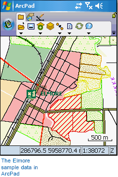
In this first exercise, you will use several layers to complete a work order in ArcPad. The primary layer that you will use is the land use layer; however, you will also use additional layers to make it easier to locate yourself and to find the parcel of land that needs to be identified. The following table provides descriptions of these layers.
| Layer | Description |
|---|---|
| aerial_elmore.jp2 | 25 cm pixel aerial photograph of Elmore, Victoria, Australia |
| customers.shp | Fictitious customers connected to the sewer network |
| land_use.shp | Fictitious land use types |
| parcel.shp | Cadastral parcels |
| Rail.shp | Railway lines |
| Rail Infrastructure.shp | Railway stations |
| Road.shp | Roads |
You do not need ArcGIS for this exercise. The exercises in this section use the sample data distributed with ArcPad. The layers are located under the Samples\Elmore folder in the ArcPad install directory. The sample data is automatically loaded on your desktop PC when you installed ArcPad. You can use the ArcPad Deployment Manager to install the sample data onto your Windows Mobile device. By default, the Elmore folder is installed in the My Documents folder on your Windows Mobile computer. The exercises require that you have write access to this data. If you don’t, you’ll need to copy the data to a location that you do have write access to.
The exercises that follow are fictitious, and they do not in any way represent real occurrences in Elmore.
In this tutorial, the word tap is used when selecting an item, as opposed to the word click. On computers that have a touch screen and pen interface, items are selected by tapping the pen on the screen. This performs the same action as clicking does when using a mouse on computers without a pen interface. In the interest of brevity, the word tap will be used, but this should also be taken to mean click.