Explore the Elmore layers provided for this tutorial. Understanding the properties
associated with each layer will help you to quickly navigate around the map.
-
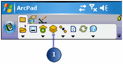
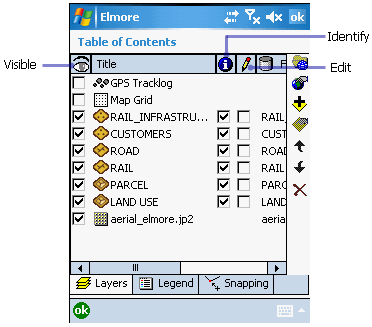
Tap the Table of Contents button. The layers you selected previously are
listed, each with a check in the Visible check box and the Identify check box.
The Edit check box is, by default, unchecked.
-
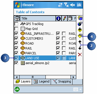
You can change the order in which layers are drawn by tapping on the Move Up or
Move Down arrow buttons. The layers at the bottom are drawn before the layers at
the top. Move the Customers layer up so that it is drawn after and on top of the
Road layer.
-
Tap the Land Use layer to select it; the layer is highlighted in blue.
-
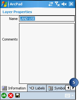
Double-tap the Land Use layer or tap the Layer Properties button. The Layer
Properties dialog box is displayed for the Land Use layer.
The Information page is displayed first; you can see that the Title field has
the name Land Use in it. This is also the title that is used to name the
layers in the Table of Contents.
-
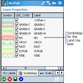
Tap the right arrow and then tap the Symbology tab to view the layer symbology.
You can change symbology directly in the field using ArcPad or via the ArcPad
Data Manager tools for ArcGIS Desktop. For more information about symbolization,
see section, Symbolizing your
data
-
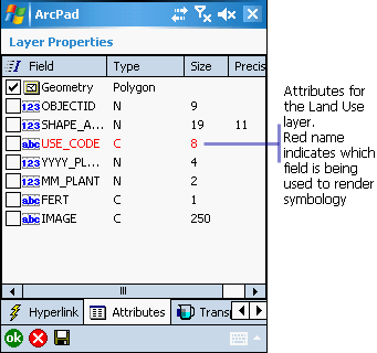
Tap the Attributes tab to see the fields associated with the Land Use layer.
The USE_CODE field is displayed in red to indicate which field is being used to
render the attribute base symbology. Later, you will change the values of these
fields after you have inspected a plot of land.
The “I” checkbox column indicates whether the layer has an index. If the
checkbox for Geometry is checked, the layer has a spatial index. If the
checkbox for a field is checked, an attribute index exists for the
corresponding field. To add an index, simply check the Index checkbox for
that attribute field.
-
Explore the additional tabs to learn more about the Land Use layer. Tap ok when
you are ready to return to the Table of Contents.
-
Explore each of the layers that you will use to help you locate the land that
needs to be fertilized.
-
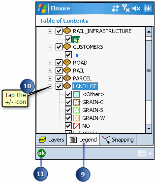
Tap the Legend tab in the Table of Contents. The Legend allows you to view and
access the symbology properties for all the layers in your ArcPad map.
-
Tap the +/- icon next to each layer to display/hide its symbology.
-
Tap OK in the Table of Contents when you are ready to return to your ArcPad
map.
-
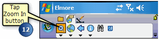
On the Browse toolbar,tap the Zoom In button.Then tap and drag a box around the
area of the image file. The rest of the exercises are concentrated in the area
of Elmore northeast of the Railway station.