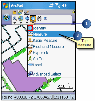
Using the Measure tool


Using the Measure tool |
|
| Release 8 |
|
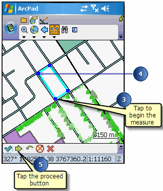
The Measure tool is activated, and the Measure button is depressed and promoted onto the toolbar. A red box around the Measure tool also indicates that it is active.
The Command bar is displayed at the bottom of the map window.
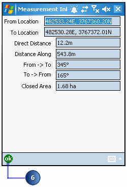
The Measurement Information dialog box displays with the following data: the coordinates (from and to location); the direct distance (from start to end); the actual distance drawn; the bearings; and if you drew more than two vertices, the estimated closed area of the shape.
Undoing or cancelling your measurement reference points: Use the Undo
tool  on the Command bar to go back a step to the previously captured point for
your measurement or use the Cancel Edits tool
on the Command bar to go back a step to the previously captured point for
your measurement or use the Cancel Edits tool  to erase all points for your measurement.