|
Modeling feature classes |
|
| Release 9.3 |    |
| Feature Ccass | Representation | Notes |
|---|---|---|
| Street centerlines | Line | Street segments split at each intersection; usually contain address ranges and network properties |
| Wells | Point | |
| Soil types | Polygon | Usually have many descriptive attributes in related tables |
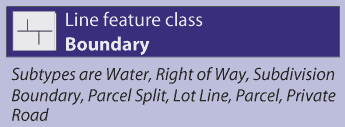
| Parcels* | Polygon | Topologically integrated with parcel boundaries and corners |
| Parcel boundaries* | Line | Has coordinate geometry and dimension attributes; participates in a topology with parcels and corners |
| Parcel corners* | Point | Surveyed corners of parcels; participates in a topology with parcel polygons and boundaries |
| Parcel annotation | Annotation | Provides text labels for lot dimensions, taxation, and legal description information |
| Building footprints | Polygon | Contains outlines of buildings and structures |
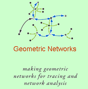
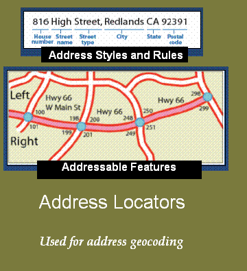 You can create locators and save copies of them independent of the geodatabase. This allows you to share your locators with many kinds of users for use in their own geocoding work.
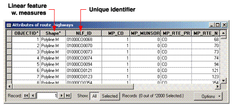
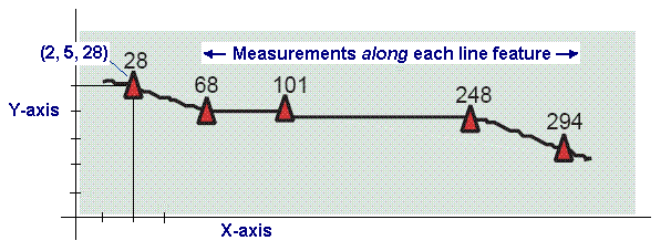 Vertices for measurements can be either (x,y,m) or (x,y,z,m).
Support for these data types is often referred to as linear referencing. The process of geolocating events that occur along these measurement systems is referred to as dynamic segmentation.
Measured coordinates form the building blocks for these systems. In the linear referencing implementation in ArcGIS, the term route refers to any linear feature, such as a city street, highway, river, or pipe, that has a unique identifier and a common measurement system along each linear feature. A collection of routes with a common measurement system can be built on a line feature class as follows:
Vertices for measurements can be either (x,y,m) or (x,y,z,m).
Support for these data types is often referred to as linear referencing. The process of geolocating events that occur along these measurement systems is referred to as dynamic segmentation.
Measured coordinates form the building blocks for these systems. In the linear referencing implementation in ArcGIS, the term route refers to any linear feature, such as a city street, highway, river, or pipe, that has a unique identifier and a common measurement system along each linear feature. A collection of routes with a common measurement system can be built on a line feature class as follows: