Author Project for ArcGIS Server


Author Project for ArcGIS Server |
|
| Release 8 |
|
Only data stored in an SDE database, can be published to ArcGIS Server and all layers contain global id's. The database must also be versioned.To learn more about SDE refer to the following link
To learn more about versioning refer to the following link.
You can import any existing shapefiles, personal geodatabase or file geodatabase layers into sde for publishing to ArcGIS Server. For more information on importing refer to the following link.
An Overview of importing datasets
'Author Project for ArcGIS Server' tool  is used to create a configuration file for publication to ArcGIS Server.
When you choose to run this tool, the 'Welcome screen' appears.
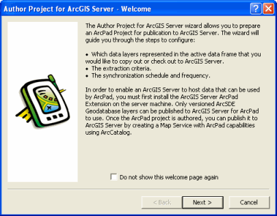
If you do not want the welcome page to appear again, check the checkbox saying 'Do not show this welcome page'. Click 'Next' and the following screen appears.
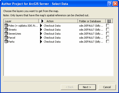
Layer
Displays the name of the layer. Relationship classes for geodatabase layers are also displayed together with the layer name.
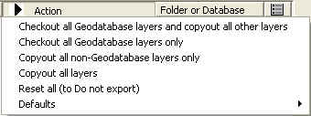
Action
On the action tab you have an option of setting the action on an individual layer or you can choose to set the same settings for all the layers. When you click on the Action tab, the following list appears.
Folder or Database
Displays the folder or the geodatabase where the layer is located.
Layer Definition Template
When checked, the Open Layer dialog is displayed allowing you to choose an existing Layer Definition from a shapefile or ArcPad AXF file to be used as a template. This allows you to re-use forms, scripts, icons, and other layer definition elements.
Spatial extent
Select the spatial extent to be used for selecting the layer features to be copied or checked out. Raster layers will also be cropped to the selected spatial extent unless the Keep Original image output option is selected.
Once layers are selected on this screen, click 'Next'. The next page of the wizard is Select Output Options.
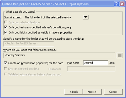
Options for the spatial extent are:
Only get selected features
When checked, only the selected features will be copied or checked out.
Only get features specified in layer’s definition query
When checked, only the features selected by the layer’s definition query will be copied or checked out.
Only get fields specified as visible in layer’s properties
When checked, only the fields which are selected as visible in the layer’s properties will be copied or checked out.
Create an ArcPad map (.apm file) for the data
When checked, an ArcPad map with the specified map name will be created on the server after you publish the ArcPad project to ArcGIS Server. The ArcPad map will reference all of the layers selected for copy out or check out, as well as the data frame properties that are supported by ArcPad.
Map name
Enter the name of the ArcPad map to be created. Default is ArcPad.apm.
Encrypt check out data
When checked, the checked out data will be encrypted in the ArcPad AXF file. The specified password will be required to use the data in ArcPad, and to check the data back in.
Password
Enter the password to be associated with the encrypted ArcPad AXF file
Validate feature classes before checking out
When checked, the geodatabase layers and features selected for check out will be validated before checking out. The validate process will stop at the first occurrence of invalid data, and report this invalid data. The invalid data should be corrected, and the check out process run again (with the validate option checked) until no invalid data is reported. All invalid data will need to be corrected in order to check out the layer.
The validation occurs in the following sequence:
ArcPad requires that all data be valid according to the defined domains. Although the validate process takes some time for larger datasets, it is highly recommended that you validate your data when using Get Data For ArcPad for the first time. This will detect and report any invalid data and provide you with an opportunity to correct the data.
Click 'Finish', and the following message box appears.:
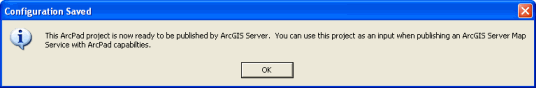
At the end of the process, an .apo file is created alongside your ArcMap .mxd document. You use the mxd and apo together to create an ArcPad publication when publishing the ArcPad project to ArcGIS Server.